For years farmers have been told they can’t manage what they don’t measure. But when there are so many variables at play, and so many tools on offer, it can be confusing to know where to start.
Sandra Godwin speaks to TurfBreed’s managing director Steve Burt who recommends two affordable solutions that use satellite and aerial images.
One is useful for monitoring turf health and managing variability, the other can help sales teams better understand the needs of their customers and provide a more personalised service.
On the farm
After years of grooming and cutting turf paddocks, most growers will have a pretty good idea of what’s happening on the ground. Even so, a second opinion is always helpful and need not cost the earth.
That’s where DataFarming comes in. The Toowoomba-based firm, in Queensland (QLD), offers free satellite farm maps providing 10-metre (m) resolution imagery every five days. There’s also a paid service with higher resolution images down to 50 centimetres pixel size.
Satellite farm maps are measured using spatial resolution, in other words, an image with 30m spatial resolution means that a single pixel represents an area on the ground that is 30m across.
In analog imagery (film), the dimension (or width) of the smallest object on the ground that can be distinguished in the imagery defines the spatial resolution.
DataFarming managing director Tim Neale said the service began with aerial photos in 2003 and evolved as the number of satellites generating high definition images increased – at last count there were more than 2500 satellites orbiting the planet.
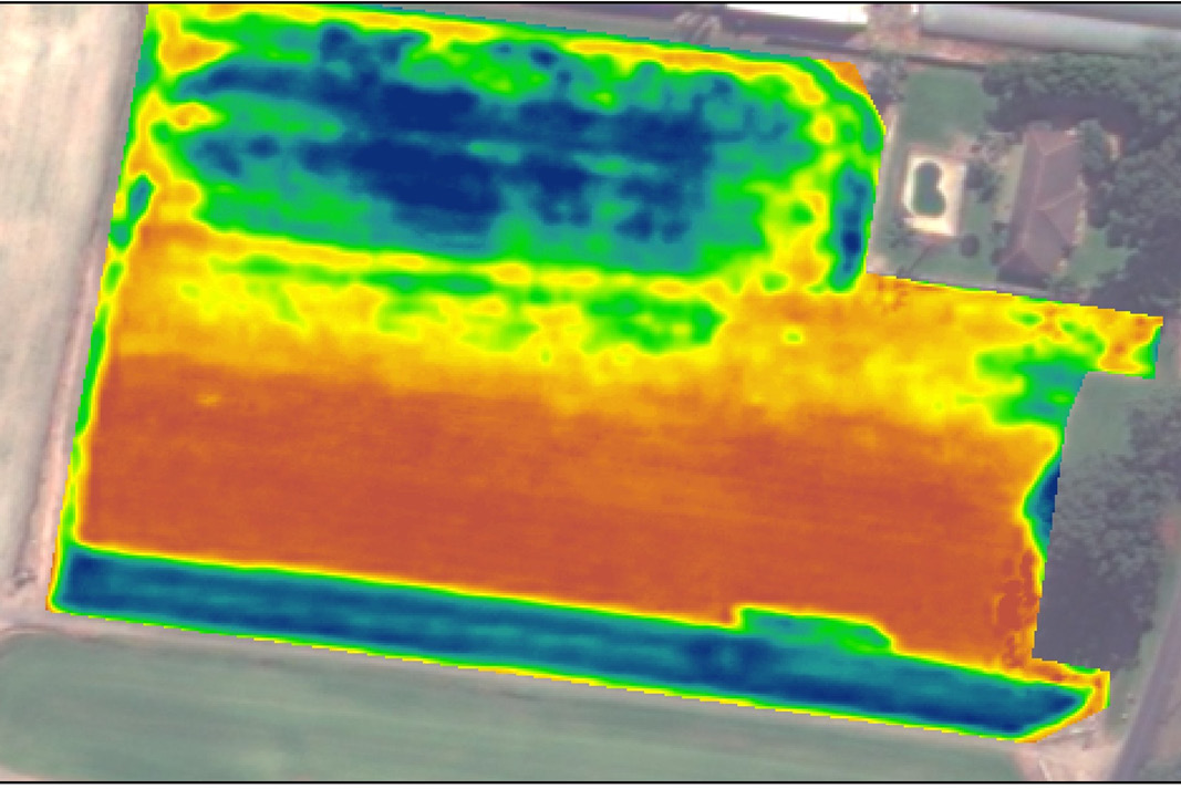
Using Normalised Difference Vegetation Index (NDVI) the images can be used to map and monitor the greenness of plants and provide a guide to crop density, anomalies, and health changes over time.
Tim explained that the images could be viewed on a computer or smart phone, allowing growers and their agronomists to identify a range of problems, from pest and disease outbreaks to nutrient deficiencies, weeds and drainage issues.
“The big advantage is picking up things, small changes, that you really have trouble seeing by eye,” he said.
“There’s a million things that can go wrong with crop growth. It detects those differences very accurately so you can go and ground truth it to understand what’s causing that.”
Tim said a common problem on turf farms occurred when parts of a paddock were under-fertilised and other parts were over-fertilised.
“Some areas produce more and therefore they extract more nutrients and you might be limiting their productivity by not having enough fertiliser,” he said.
“Or when a wet area of the field is not growing very well, you probably over fertilise this area.
“It’s all about matching the inputs to the outputs … the right place, right product, right time, that kind of thing.”
TurfBreed managing director Steve Burt said he uses the NDVI maps to highlight a range of paddock issues, from dry spots to nutritional issues, and identify sites for soil and leaf testing.
TurfBreed managing director Steve Burt says he uses the NDVI maps to gain an understanding of turf supply and crop development. He finds access to images from previous months and years useful for identifying when turf has been harvested and the development stages of regrowth leading into being ready to harvest again.
“I’m also using this as a way of seeing what turf is ready for harvest,” he says, referring to an images of one of our turf farms showing both 10 metre and high resolution imagery.

“I’m seeing here in this instance that there’s two substantial blocks that are blue – blue is healthy turf – so we can get an idea of where our turf farms are up to at any given time for planning purposes.”
He has also experimented with using these images for verifying and responding to customer complaints.
Growers can get started with a free satellite farm map with NDVI at 10 square metres or buy higher resolution one square metre images providing multi-year views of paddock performance for $10 per hectare (minimum fee applies).
More details: www.datafarming.com.au
In the “Nearmap” market
Founded in Perth in 2007, Nearmap now has aerial maps of more than 100 urban areas, covering more than 446,000 square kilometres and 89 per cent of the Australian population.
Nearmap’s services are popular with property developers, government departments, utilities and transport and construction companies.
TurfBreed managing director Steve Burt says Nearmap was one of the first mapping services he signed-up for when TurfBreed began operating in November 2017.
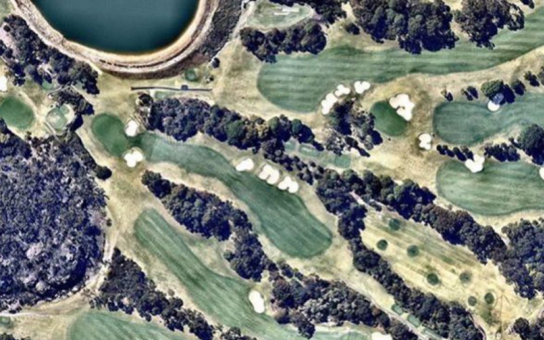
Like NDVI maps, the high-resolution images are beneficial for remotely monitoring TurfBreed’s turf farms: providing a bird’s eye view of the turf and the ability to double-check when different varieties and paddocks are ready for cutting.
Steve said their real value, however, is in the information available to growers and sales teams dealing with phone enquiries and building quotes for a range of jobs, from an individual household size to large commercial and civic projects.
“Someone rings me up and says ‘I want some advice on turf’,” he said.
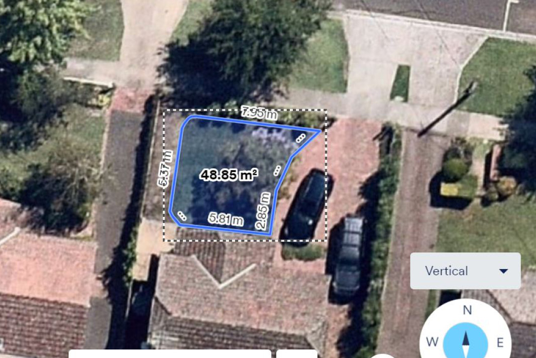
“I will then go on to Nearmap, plug in the address and look at their property. I can tell how much turf they’re going to need, what the aspect of the property is – what’s around it, such as trees and shade.
“It’s really important to understand the shade characteristics and that helps me then understand what turf I should be recommending.
“Nearmaps allows me to relate to the customer and say, ‘I’m looking at your house now’. That really gets their attention.”
PhotoMapsTM allow users to instantly view a property with +/- 15cm accuracy at 200 feet, verify unique details and take precise measurements using tools within the Nearmap web app,
MapBrowser, without an onsite visit. It speeds up the quoting process and helps make a lasting positive impression with the customer.
Using a demonstration image from one of our turf farms to compare with Data Farming NDVI imaging

“In this case, a buffalo might work better in the shade than a zoysia or a couch,” he says. “I can also see what the access is like and whether I can get my truck in there. This is an amazing, relatively cheap tool that can help me gain a better understanding of my customers, build loyalty and improve sales.”
Free Nearmap demonstrations are available. Pricing is tailored to the needs and usage of each business.
Sample images from Australia and across the globe can be viewed on the website and at the Nearmap Instagram account https://www.instagram.com/nearmap
More details: www.nearmap.com

